Le refuge de Temple Écrins Été 2024
Open
Pedestrian access St Christophe :
At the foot of the Venosc gondola, walk down to the Bourg d'Arud bridge and join the path to Plan du Lac. At the white-water base, follow signs for Le Puy / Saint Christophe en Oisans.
On leaving St Christophe, follow Pré Clot, then Champhorent. Take the road to the municipal campsite. Cross the bridge and follow the path to La Bérarde.
Please note: access to and visits to La Bérarde (Saint-Christophe-en-Oisans) are strictly forbidden until further notice > Saint-Christophe-en-Oisans municipal by-law, dated 22/06/2024.
TECHNICAL INFORMATION :
Start: La Bérarde camping bridge
Difference in altitude: 670 m
Duration: 2h30
Distance: 7.7 km
Level: difficult
ROUTE :
From the campsite bridge, follow the new path to the Plan du Carrelet via the Vallon du Chardon.
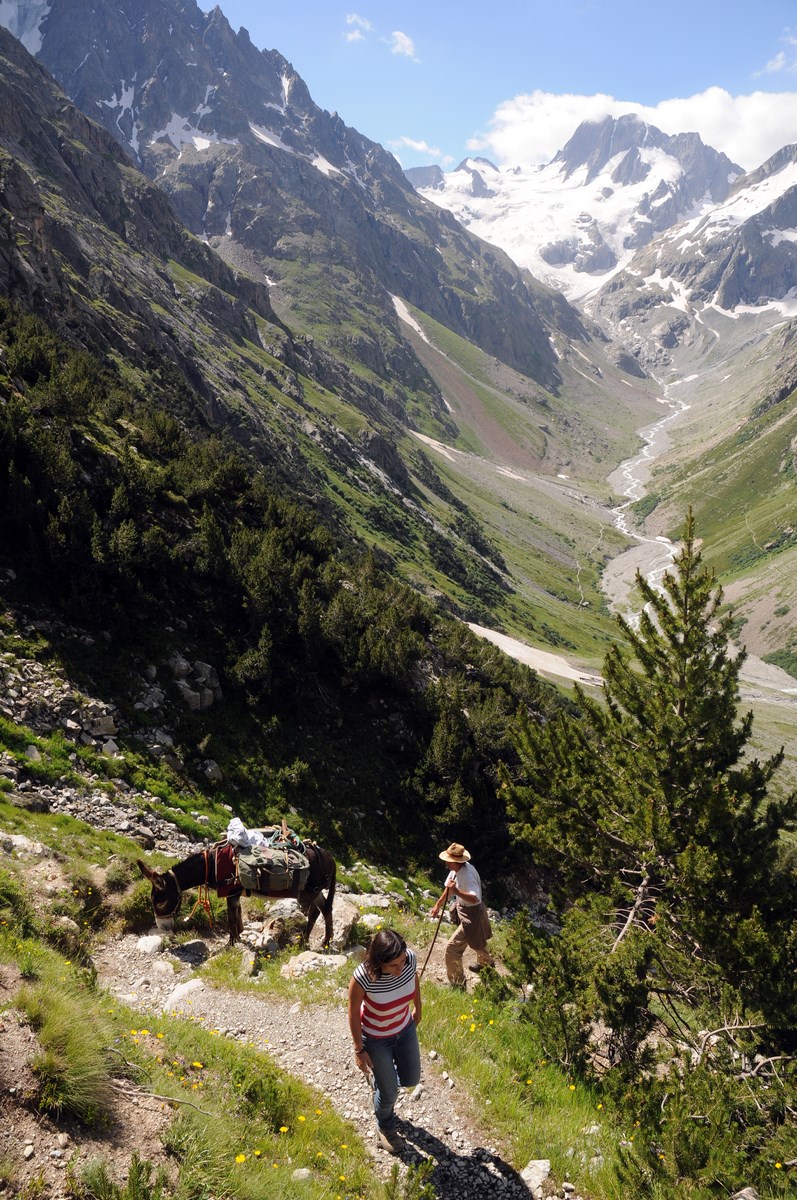
Then begins the ascent to the Refuge de Temple Ecrins. Leave the main path and take the path that rises to the left at the crossroads. You'll find yourself in a forest of hooked pines: the shape of some of the trunks says a lot about the harshness of the climate! At the end of the forest, there's a magnificent view of the Pilatte glacier, source of the Vénéon, and the rest of the hike can be done with your nose in the air!
You then reach the alpine meadow, before the refuge quickly becomes part of the landscape, with its terrace stretching out its arms to you.
"YOU'RE HIKING IN THE HEART OF THE ECRINS NATIONAL PARK
The Écrins massif is an exceptional area, open to all, with a rare natural, cultural and landscape heritage. To protect these treasures, the heart of the park is marked with blue-white-red painted flags, where regulations must be respected. Please take note of them when preparing your hike to preserve this collective asset on the ecrins-parcnational.fr website."
Dogs not allowed, even on a leash.
THINGS TO SEE ON THE TRAIL :
Rhododendrons, gentians and many other mountain flowers can be seen in the alpine meadows. Chamois and marmots are often seen near the refuge.
NOTES:
The Refuge de Temple Ecrins is the starting point for a number of challenging routes, including the Traversée des Ecrins and Pic Coolidge.
The RD530 leading to Vénosc, Saint-Christophe-en-Oisans and La Bérarde is closed to vehicular traffic, from the intersection with the RD1091 (at the Clapier d'Auris locality) to the hamlet of Les Étages (Saint-Christophe-en-Oisans), via Venosc (Les Deux Alpes), except for local residents.
En pratique
- Non acceptés
Publics
- Level red – hard,
- Groups
Animaux acceptés
- Non acceptés
Informations complémentaires
Langues parlées
- French
Durée moyenne d'une visite groupée
- 150h
Ouvertures
From 15/05 to 31/10.
Subject to favorable snow and weather conditions.
Périodes
- Autumn,
- Summer,
- Spring
Tarifs
Free access.
Tips
The refuge is guarded from June to September, Don't forget to book.
Go there
Latitude : 44.904919
Longitude : 6.332116
Height : 2414
38520 Saint-Christophe-en-Oisans - La Bérarde
Go there
Within the boundary of the Ecrins National Park, so no dogs allowed.
Information mise à jour le 06/09/2024
par Oisans Tourisme


